konkurranseprogram-KUNSTKANTEN

OBS! Se svar på ofte stilte spørsmål (FAQ) i bunnen av dokumentet!
(English follows below)
KUNSTKANTEN er tenkt som en kuratert utendørs visningsarena langs kyststien som nå bygges i Bodø, en sti som i første omgang vil danne en sammenhengende forbindelse mellom Bodøsjøen og Mørkvedbukta. Stien gjør det mulig for folk å gå eller sykle langs kysten og oppleve ulike naturområder, landskap og nærområder. Visningasarenaen vil i første omgang kurateres som fem skulpturpunkter som viser fem verk over en periode på to år.
AKTØRER
KUNSTKANTEN er et nyetablert utendørs visningsrom, finansiert av Bodø2024. Den første utstillingsperioden på to år kurateres og administreres av Norsk Billedhoggerforening. Prosjektet gjennomføres som en konkurranse hvor fem verk blir tildelt en produksjonsstøtte på 350.000, samt utstillingsvederlag på 50.000 for to år. Bodø kommune er eier av prosjektet.
STEDET
Bodø er et attraktivt sted både for mennesker, dyr, fly og fugler. I eldre steinalder (8000 til 4000 f.kr) lå havet 80 meter høyere enn i dag og hele byen lå under havoverflaten. Isbreene dominerte innerste del i Saltfjorden og mobile jegere og sankere brukte området. I yngre steinalder hadde all is forsvunnet, og havet sto 40 meter høyere enn i dag. Jordbruket kom til regionen og store områder ble omgjort til kulturlandskap. Norges nest eldste registrerte bosettingsfunn ble funnet i Bodø og første bebyggelse var for rundt 10 000 år siden.
Gode fiske- og beitemuligheter trakk mennesker til området rundt Saltstraumen. Da byen ble grunnlagt 20. mai 1816 ville man etablere Bodø som en handelsby for nordnorske fiskere. Det gikk ikke helt etter planen, for handelsmønstret fortsatte å gå mellom Lofoten og Bergen. Til tross for økt fokus på handel var den vær- og vindutsatte halvøyen preget av landbruk, beite og fiske. Både norske og samisk gårder var tilknyttet området og holdt frittgående husdyr som rein, kyr og sau.
ENDRINGSHISTORIEN
Befolkningsveksten økte betraktelig da jordbrukerne produserte mer mat enn de behøvde og det åpnet for nye yrker som håndverkere og krigere. Lenge var Bodø et relativt ubetydelig sted, og først med de rike sildeårene i 1860- og 1870-årene fikk kjøpstaden et oppsving. Ved forrige århundreskifte levde ca. 5000 mennesker i Bodø. Helt frem til andre verdenskrig var imidlertid Bodø en heller liten by. Store deler av byen ble bombet under krigen, men ble raskt gjenoppbygd som NATOs nordligste kampflybase i 1952. Omtrent halvparten av Bodøhalvøya ble sperret av og øremerket militær Nato-beredskap. Bodø er et stort trafikknutepunkt hvor både sjø-, land-, og lufttransport møtes.
Bodø lufthavn er en kombinert flyplass for militær og sivil trafikk, der man veksler mellom stamruter og regionale ruter ut til de mange kortbaneflyplassene i regionen. Flyplassen er også operasjonsbase for Hovedredningssentralen for Nord-Norge.
I 2012 vedtok Stortinget å legge ned Luftforsvarets base Bodø – det vil si den militære delen av flyplassen. I januar 2022 ble den operative basen lagt ned.
De tre skulpturpunktene på Hunstad og Alstad går i dialog med utviklingen av byen som skjedde på 1970-tallet. Da ble gårdsanlegg og naturområder erstattet med industri- og boligfelt. Industrien er i dag på hell og flere gamle anlegg er revet. Flere boligområder er blitt etablert og nye kommer, og ikke minst finnes det en stor satsning på rekreasjonsområder. Kyststien er et godt eksempel på dette.
Byen skal i løpet av de neste 50 til 100 årene få en ny bydel, og ambisjonene for smarte, grønne løsninger er høye. Forutsetningene for teknologisk bærekraftig utvikling er gode, i et område som har tilgang på rene råvarer og fornybar energi. I 2024 er Bodø Europeisk Kulturhovedstad, hvor formålet er å bringe Europas befolkning sammen, med kunst og kultur som mål og middel. Prosjektet har fått navnet Bodø2024. Bodø2024 ønsker å bidra til spørsmål og skape dialog rundt byens og menneskenes identitet i fornyelsesprosessen byen står ovenfor. Kanten av byen skal flyttes nok en gang. Landskapet vil bli forandret. Naturområder vil gå tapt og nye nabolag og miljøer vil oppstå.
BODØ KYSTSTI
KUNSTKANTEN er tilknyttet Bodø kyststi og vil i fremtiden kunne videreutvikles i takt med utviklingen av kyststien.
Første del av Bodø kyststi mellom Bodøsjøen og Mørkvedbukta skal etter planen ferdigstilles og åpnes i 2024. Stien skal deretter videreføres fra Bodøsjøen, over den eksisterende flystripen, via flyterminalen som lik flystripen vil bli avviklet i nær fremtid, inn mot Bodø sentrum, langs havnen og forbi Kulturkvartalet. Traséen passerer så Hurtigruteterminalen, går inn i Rønvikleira, ut forbi industriområdet på Burøya og frem til Nyholmen Skandse som er endepunktet. Denne forlengelsen av stien vil ikke bli realisert før etter 2024 og etter at ny flyplass er bygd og åpnet.
Bodø kyststi tilbyr helt spesielle naturopplevelser. I presentasjonen av Bodø kyststi heter det at «Kysten har en helt særlig plass i den lokale folkesjela i Bodø, hvor nærhet til naturen står sterkt. Bodøværingene trekker mot kysten når været er spesielt godt – eller uvanlig rufsete, og det er nettopp kontrastene og den evige foranderlige opplevelsen langs kysten som er så tiltrekkende.»
Bodø kyststi er spesiell i det at den ikke bare tar deg gjennom et typisk nordnorsk kystlandskap. Den går langs randen av byen og bukter seg gjennom flere typer terreng og områder, forbi steder med lokalhistoriske betydning og eldre og nyere boligområder. Den planlagte forlengelsen av stien vil passere en nedlagt flyplass med tilhørende militære installasjoner, et bysentrum og havneområde, den tar deg også forbi industrianlegg som har vært og som fortsatt er viktige for byen. Denne delen av kyststien vil kunne få karakter av en byvandring der du følger en merket trasé gjennom byen. Her vil det om mulig å legges inn flere severdigheter, fasiliteter og bevertning som høyner den totale opplevelsen og skaper rom for sosialisering. Konseptet handler ikke kun om å gå eller å sykle, men om å oppleve, diskutere, dele og bruke tid sammen.
Kyststien inviterer til eierskap og engasjement. Følger du kyststien beveger du deg gjennom epoker som har satt preg på byen og som vil prege den i fremtiden. Den går forbi steder som forteller om hvordan Bodø ble til, hvilke impulser og premisser som har formet byen og som kan påvirke dens fremtid. Du får føling med jektetiden, du går forbi den gamle militære flyplassen, gjennom et bysentrum og havneområde i ekstrem forvandling, du passerer den gamle og fortsatt eksisterende fiskeoljefabrikken på Burøya og til slutt ender du på det rekonstruerte fortet Nyholmen Skanse som markerer byen opprinnelse, dette for å nevne noe av severdighetene som vil ligge langs stien. De peker på ressurser, forbindelser, allianser, nettverk og handelsruter – gamle som nye – som har preget og fortsatt preger byen, og som setter den i forbindelse med omverdenen og et større sivilisatorisk tankegods.
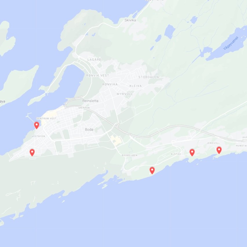
INFORMASJON OM DE FEM STEDENE
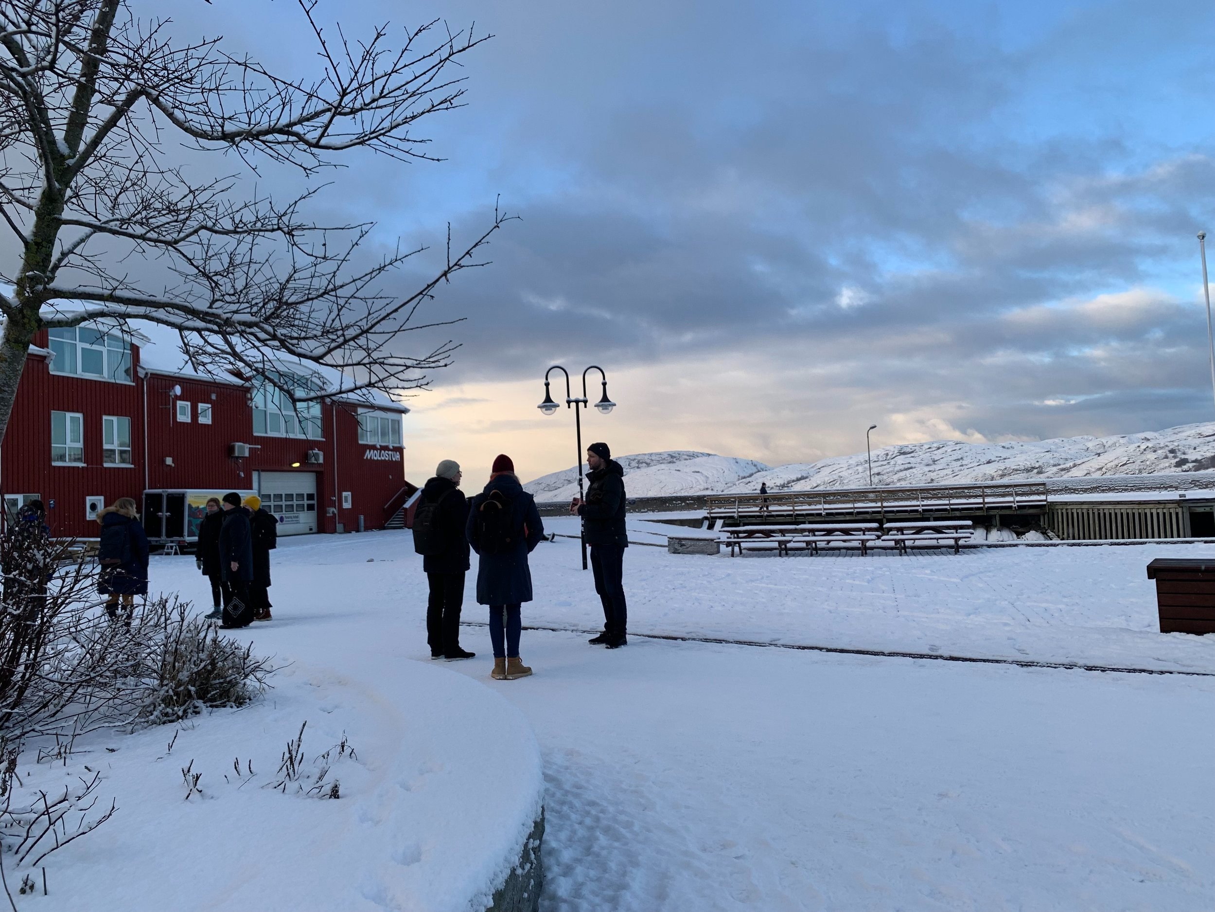
1. Molorota/Tønder Bay
Molorota, også kalt Tønder Bay er et sentralt sted for Bodøs befolkning da tusenvis av Bodøværinger ukentlig passerer stedet på vei ut til Moloen. Tønder Bay er oppkalt etter tidligere havnesjef Ragnar Tønder som i sin tid ga byen et anker som lenge prydet plassen. Plasseringen ligger i rota av småbåthavna med utsikt ut mot havnepromenaden med Stormen bibliotek i bakgrunnen. Stedet ligger på grensen mot den nye Molobyen, en helt ny bydel under utvikling. Les mer om det her:
https://bodo.kommune.no/arealplaner/omradereguleringsplaner/molobyen
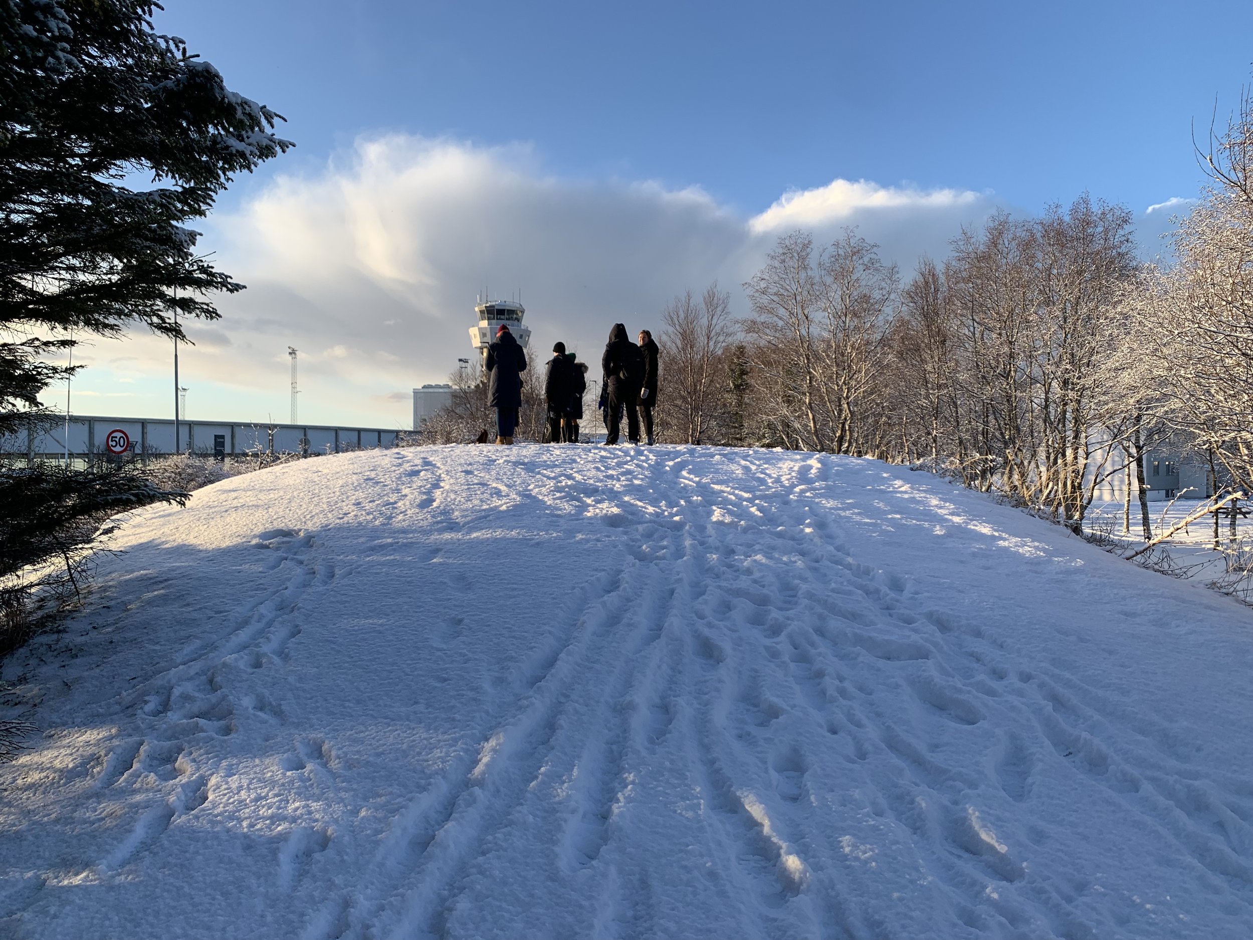
2. Haug ved Bodø Lufthavn
Rett ut av terminalbygningen til Bodø Lufthavn, over veien, vil du få øye på en liten haug ved siden av gangstien som tar deg ned mot Bodø sentrum. I bakhånd ligger et boligfelt med blokker, mens selve stedet på haugen har utsikt forbi flyplassen med Børvasstindan i bakgrunnen. Dette er i dag en haug som kun blir brukt som friluftsområde.
Når den nye flyplassen er på plass, og ny bydel skal etableres, vil dette stedet være i skjæringspunktet mellom ny og gammel bydel. Les mer om nyby-prosjektet her:
https://bodo.kommune.no/arsrapport2018/naring-og-byutvikling/ny-by-ny-flyplass/
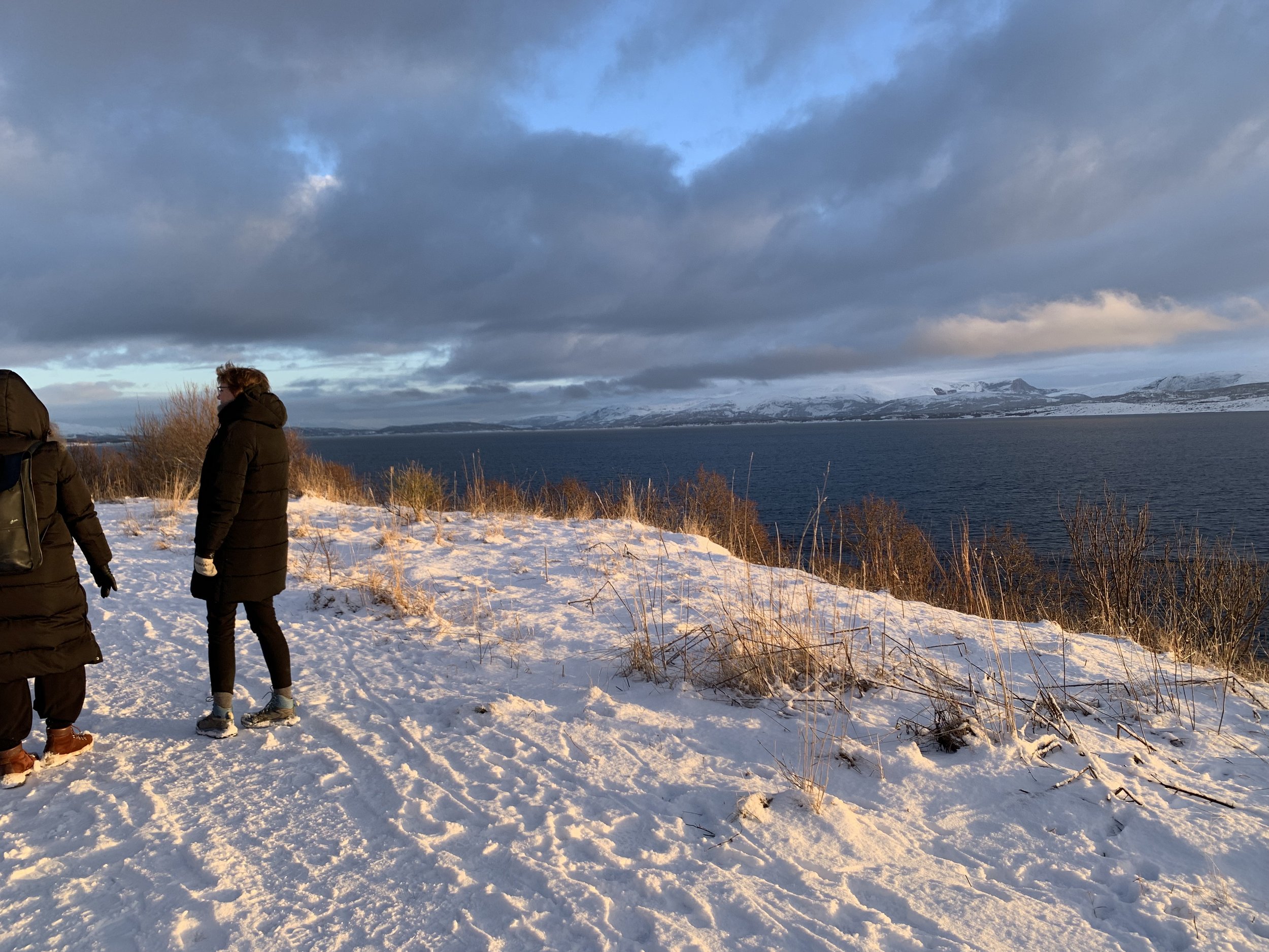
3. Nedenfor boligfelt i Toftveien.
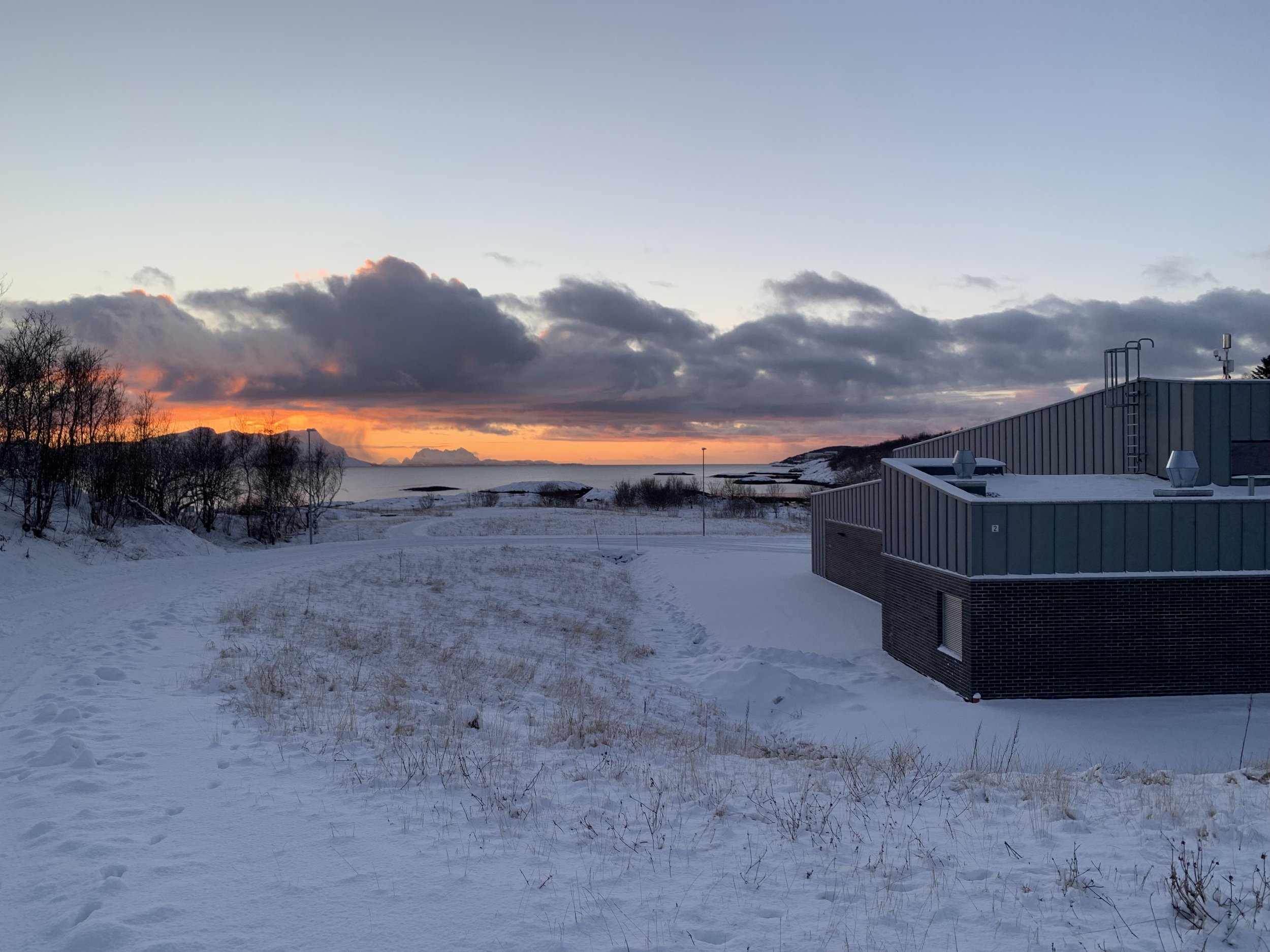
Dagens kyststi, som ble etablert i 2011, strekker seg 1,2 km fra friluftsområdet Bodøsjøen til boligfeltet Blokkan i Tofteveien. Dette er en meget populær turdestinasjon som brukes hver dag av både tobente, firbente og folk på hjul. På enden av denne løypa, på et lite flatt område ved siden av stien, noen meter opp fra fjæresteinene, vil denne plasseringen ligge. Lett tilgjengelig med en sti tilknyttet boligfeltet, men skjermet fra boligene av å ligge litt ned i skråninga. Her har du utsikt rett ut i havet med Børvasstindan i det fjerne. Sterkt utsatt for vær og vind.
4. I Lauvåsveien/Alstadløkka
Langs Lauvåsveien, før den kommende kyststien skrår ned mot fjæra, finner du neste plassering. Stedet ligger som limt inn mot gang- og sykkelstien rett nedenfor et boligfelt ved en gammel fotballøkke. Stedet brukes til daglig av turgåere, pendlere på sykkel, og utflukter for barnehager og skoler. Plasseringen har utsikt forbi fotballøkka og ned mot Innervika, ei lita bukt og ei strand der lokalbefolkningen årlig lager til et stort St. Hans-bål.
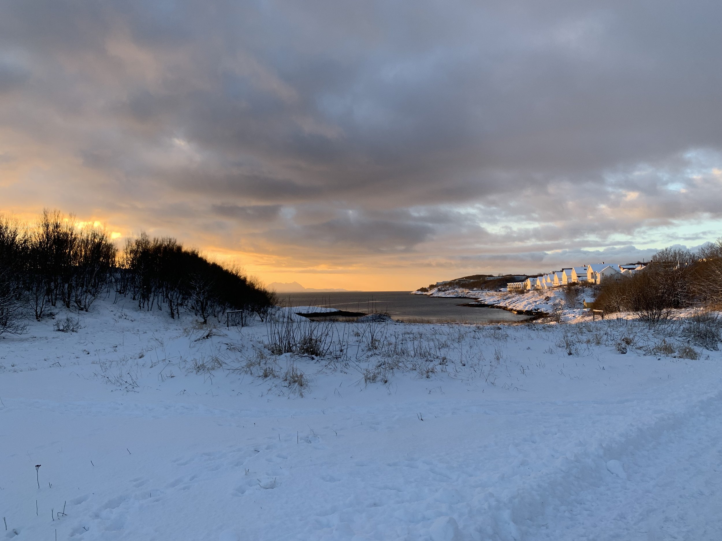
5. Nedenfor renseanlegget i Stokkvika
Nedenfor en asfaltert vei tilknyttet et renseanlegg, finner du et stort flatt område i en liten bukt. Plasseringen ligger nesten ned i fjæra, med kyststien noen meter bak. Området brukes daglig til utflukter for barnehager og skoler, samt turgåere. Her har du spektakulær utsikt ut i havet, og kan til og med speide punkt 3 nedenfor Blokkene og Toftveien.
BILDER OG KART FØLGER I BUNNEN AV DOKUMENTET
COMPETITION PROGRAMME –KUNSTKANTEN
You will find answer to frequent asked questions (FAQ) at the bottom of the document!
KUNSTKANTEN is conceived as a curated outdoor exhibition arena situated along the coastal path now being built in Bodø – a path that will initially connect the area called Bodøsjøen with the bay Mørkvedbukta. The path makes it possible for people to walk or bicycle along the coast and experience diverse natural environments, landscapes and local areas. For the first two-year period starting in 2024, the exhibition arena will be curated as five ‘sculpture points’, each presenting one work.
ACTORS
KUNSTKANTEN is a newly-established outdoor exhibition arena financed by Bodø2024. The first exhibition period lasts two years and is curated and administered by the Norwegian Sculptors Society. The project is carried out as a competition. Five works will be awarded financial support, each one receiving 350,000 NOK to cover production costs, plus an exhibition honorarium for the two years: a total of 50,000 NOK. Bodø Municipality is the owner of the KUNSTKANTEN project as a whole.
THE LOCATION
Bodø is an attractive place for people, animals, aeroplanes and birds. In the older Stone Age (8000–4000 BC), the sea level was 80 metres higher than it is today, so the entire area where the city now lies was under water. Glaciers dominated the innermost part of Saltfjorden, and hunters and gatherers roamed the landscape. By the later Stone Age, all the ice had melted and the sea level was 40 metres higher than it is today. Agriculture had begun in the region and large areas were transformed into cultural landscape. Norway’s second-oldest registered settlement is in Bodø, and the remains of the first buildings are thought to be more than 10,000 years old.
Good opportunities for fishing and hunting attracted people to the maelstroms in Saltstraumen (strait), 33 km from Bodø. When Bodø gained township status on 20 May 1816, local actors wanted to establish it as a trading centre for North Norwegian fishermen. Things did not develop according to plan because the already-established pattern of trade continued between Lofoten and Bergen. Despite the increased focus on trade, the windswept peninsula was marked by agriculture, grazing and fishing. There was both Norwegian and Sámi farming in the area, and livestock such as reindeer, cattle and sheep ranged free.
THE HISTORY OF CHANGE
The population increased substantially when farmers produced more food than they needed and people could take up new occupations, for instance in crafts and the military. Bodø was a relatively insignificant place for a long time, and it was not until the 1860s and ’70s, when herring was bountiful, that the market town experienced an upswing. Around 1900 Bodø had about 5,000 inhabitants. It remained a small town up to the Second World War. Large parts of Bodø were then bombed, but by 1952 the area was rebuilt as NATO’s most northern air force base. Approximately half of the peninsula was cordoned off and earmarked for military NATO preparedness. Bodø is now a hub where transport by sea, land and air intersect.
Bodø Airport handles both military and civilian traffic, with passengers switching from international, national and regional routes to the many short-runway airports in Northern Norway. Bodø Airport is also the headquarters for Northern Norway’s Search-and-Rescue Services.
In 2012 Norway’s parliament resolved to shut down the Royal Norwegian Air Force’s base in Bodø, that is, the military part of the airport. In January 2022 the operative base closed.
The three locations designated as sculpture points at Hunstad and Alstad enter into dialogue with urban development from the 1970s. It was then that farms and parts of the natural landscape were replaced by industrial buildings and housing developments. The factories are now on the wane and several old structures have been razed. Housing areas have been developed and new ones are on the drawing board. Worth noting is that there is now much emphasis on recreational areas. The coastal path is a good example of this.
During the next 50 to 100 years the city will gain a new district, and ambitions for smart, ‘green’ solutions are high. There are good preconditions for technologically sustainable development, in an area with access to ecologically-grown goods and renewable energy. In 2024 Bodø will be a European Capital of Culture, the aim of which is to bring Europe’s population together through the means of art and culture. The ECoC project (Bodø2024), seeks to contribute to raising questions and generating dialogue about the identity of the city and the local population in the renewal process the city now faces. The city’s boundaries will once again change. The landscape will be transformed. Areas that are now wild nature will be lost and new neighbourhoods and environments will emerge.
BODØ COASTAL PATH
KUNSTKANTEN is linked to Bodø’s coastal path. In years to come it will be possible to develop the art project further, parallel to the path’s own development.
The first section of Bodø’s coastal path, which is between Bodøsjøen and Mørkvedbukta, is scheduled to open in 2024. After this, the path will be extended: from Bodøsjøen, across the existing runway, via the airport terminal, which, like the airstrip, will be closed down in the near future. The path will then head towards Bodø’s town centre, along the harbour and past the cultural quarter (Kulturkvartalet). From there it will pass the terminal for express boats (Hurtigruten), enter the industrial area called Rønvikleira, then head out past the industrial area on Burøya and lead on to Nyholmen Skandse – the end point. This extension of the path will not be realised until after 2024, after the new airport has opened.
Bode’s coastal path offers very special experiences of nature. In the presentation of it, one reads that ‘the coast has a unique place in the local population’s soul, where proximity to nature stands strong. Bodø’s inhabitants are drawn to the coast when the weather is particularly nice – or uncommonly rough, for the contrasts and ever-changing experience of the coast are what they find so appealing’.
Bodø’s coastal path is special in the sense that it doesn’t just lead you through a typical North Norwegian coastal landscape. It runs along the city’s border and meanders through different types of terrain and areas, past places with local historical significance and older and newer residential areas. The path’s planned extension will pass through a shut-down airport with military installations, a city centre and harbour area, and it will wend past industrial sites that have been and remain important for the city. This part of the coastal path may take on the character of a city walk where you follow a marked route. Here, if possible, several more attractions can be added, including pubs and cafés that can heighten the total experience and be spaces for social interaction. The concept is not just about walking or bicycling, but also about experiencing, discussing, sharing and spending time together with others.
The coastal path encourages a sense of ownership and involvement. When traversing it, you move through historical periods that have left their mark on the city and will continue to do so in the future. It takes you past places that tell stories about how Bodø came into existence and the impulses and preconditions that have shaped it and can influence its future. You gain a sense of jektetiden, the time when dry cod and other goods were transported from Bodø to Bergen in traditional small sailing ships called jekts. You pass the old military airport, walk through a city centre and harbour area undergoing extreme transformation, past the old and still-operational fish-oil factory on Burøya, and end up at the reconstructed fort Nyholmen Skanse, which marks the location of the town’s origin. These are only some of the sites that will be alongside the extended path: they point to resources, connections, alliances, networks and trade routes – old and new – that have made and continue to make their mark on the city, linking it with the surrounding world and a larger body of civilisational ideas.
INFORMATION ABOUT THE FIVE LOCATIONS
1. Molorota/Tønder Bay
Molorota, also called Tønder Bay, is a nodal point for Bodø’s inhabitants inasmuch as thousands of them pass it ever week on their way to Moloen (the breakwater). Tønder Bay is named after the former port manager Ragnar Tønder, who in his day gave the city an anchor that stood on the site for many years. The sculpture point is at the innermost part of the small-boat harbour, with a view towards the promenade and public library ‘Stormen’ in the background. The spot lies on the border of Molobyen, a new housing area currently being developed. Read more about it here:
https://bodo.kommune.no/arealplaner/omradereguleringsplaner/molobyen
2. Hill next to Bodø Airport
Just outside Bodø Airport’s terminal building, across the street, there is a hill next to a walking path leading down to Bodø city centre. In the background is a neighbourhood with apartment buildings. Standing on the hill itself, one has a view extending beyond the airport, to the mountains collectively called Børvasstindan. This area is today used for outdoor recreation.
When the new airport is completed and the new urban area is established, the hill will be an intersection between the old and new urban areas. Read more about the new airport/urban-development project here:
https://bodo.kommune.no/arsrapport2018/naring-og-byutvikling/ny-by-ny-flyplass/
3. Below the housing area at Toftveien
The current coastal path, which was established in 2011, stretches 1.2 km from the recreation area at Bodøsjoen to the neighbourhood called Blokkan on the street Toftveien. This is a popular destination for bikers and walkers (both two and four legged). The sculpture point will be at the end of this stretch, on a small flat area beside the path, some metres up from the rocks along the shore. It is easily accessible and connected to a path leading to the housing area, but it cannot be seen from the houses due to its location slightly down the slope. Standing here, you have a view straight out to sea, with Børvasstindan in the distance. The location is exposed to weather and wind.
4. On Lauvåsveien/Alstadløkka
The next sculpture point is along the street Lauvåsveien, right before the coastal path’s projected extension slopes down towards the shore. One gets the feeling of the place being glued up against the walking/bicycle path, just under a housing area next to an old open field where football is played. The place is used daily by walkers, bicyclists commuting to work, and kindergarteners and school children on excursions. The location has a view looking past the playing field, down towards Innervika, a small bay with a beach where the locals build a bonfire at midsummer.
5. Below the waste-water treatment plant in Stokkvika
Below an asphalt road leading to a waste-water treatment plant, you can find a large flat area in a small bay. The placement is almost at the shoreline, with the coastal path some meters behind it. The area is used daily by kindergarteners and school children out and about, and by walkers. Here there is a spectacular view looking out to sea, and you can even see sculpture point 3 below the housing development and Toftveien.
BILDER OG KART/PICTURES AND MAP (klikk på ikonene for flere bilder/info / click the icons for more pictures/info)
FAQ
Is the competition open to any nationality? Yes
Can groups apply? Yes
What does the limitations om 3D model mean? The limitations on 3D-model means you can't ship or deliver a physical model. But digital 3D is ok.
Is shipping covered? The project covers shipping up to 20.000 NOK and assembly internally in Bodø.
Is installation covered? The project covers transport from storage in Bodø, lifting by crane (see limitations below) and simple fixing to the concrete base. Complex installations must be covered within the production budget of each artist.
Does the two paid travel dates include accomodation? No, just travelexpences. It is expected that you travel in the most reasonable way.
Is there a residency option in Bodø for producing the artwork? Not by the time being, but we can do an inquiery about this if required when the artists has been selected.
Will a possible residence be covered by the project's budget? No, this must be covered by the granted production fee.
Could there be any kind of guidance or followup from the organizing institutions regarding contact with builderst, supplier of materials etc? We can do some guidance, but it’s the artists responsibility to convince the jury that the proposed artwork is possible to implement in practice.
Is there any weight- or size restriction? At Molorota/Tønder Bay the artwork should not exceed 1000kg. The artist must also be aware that it must be possible to place the artwork in the desired location. All locations are accessible by crane. At Toftveien and Alstadløkka, the crane truck can lift up to 4 tonnes and at Stokkevika and Bodø Airport, the crane truck can lift approx. 1 ton. If the artwork comes in modules, the work may be heavier than 4 tonnes in total, except at Molorota/Tønder Bay. The artwork must fit inside the the assigned area. There is basically no height restriction, but height must be within reasonable limits and not interfere with any infrastructure (power lines etc.).
What is the exact size of the concrete modules that serve as a platform for the artworks? The total space is 400x400cm concrete. Thickness is app. 30cm. An update on thickness and size on each module is coming.
How is the artworks to be fixed to the base? It is possible to drill into the concrete elements if needed. At Molorota/Tønder bay, the artwork must be self-supporting with its own base.